
There will be an ASPRS Student Advisory Council (SAC) webinar on Tue, June 11 at 8 pm eastern time. This will be an open meeting for all ASPRS student members. You are welcome to attend and discuss ongoing projects of the council, and make recommendations for additional project to consider. Also, you can learn about upcoming openings on the council and the application process. Click here to register.
Thursday, 6 June 2013

ASPRS Map Competition
Student Map Competition

Participate in a fun, challenging and exciting project: The Student Map Competition at the CaGIS/ASPRS 2013 Specialty Conference in San Antonio, Texas!
Date: October 29-30
Materials Deadline: October 1, 2013
Download the Competition Details in PDF Here.
Responding to disaster events requires a quick response on the part of public officials in order to protect the public. Maps are one means of communication that public officials use to warn citizens of potential danger. Often the final map used to communicate these dangers is a product of both complex data analysis and cartographic design. In recent years the importance of these methods of analysis and design on our ability to efficiently communicate information has become clear. Examples such as the Haitian earthquake in 2010, Hurricane Sandy in 2012, and the recent tornadoes in Oklahoma, are just some of the examples of the importance of information communication about natural disasters. This challenge focusses on the use of data from Hurricane Ike, a category 4 hurricane that took place in September 2008. This hurricane made landfall along the Gulf Coast, and affected the city of Galveston, Texas.
The Challenge
The application of geospatial tools to predict the location of potential natural hazards and to inform and manage public response requires collaboration between scientists across disciplines. The objective of this competition is to demonstrate an ability to work collaboratively to determine the best methods for (a) developing predicted inundation areas using storm surge predictions and topographic information for the Galveston, Texas area; (b) merging predicted inundation information and evacuation routes to create a map to help the public understand the potential for impact in their geographic area and appropriate evacuation routes from their areas to safe zones.
The data for this competition is freely available from three government agencies. You will need to obtain storm surge data for Hurricane Ike from the National Hurricane Center (NHC) and combine it with 10m topographic data from the U.S. Geological Survey (USGS). Federal Emergency Management Agency (FEMA) evacuation routes are also available online. Links to these datasets are provided on the full competition details online at http://www.asprs.org/Conferences/San-Antonio-2013/Program/Map-Competition.
Your success will be judged on the map or visualization product (suitable for a public audience), a written document detailing the methods you used to arrive at the map product, and an oral presentation of 10 minutes at the CaGIS/ASPRS Fall Meeting in San Antonio, Texas.
Wednesday, 22 May 2013
Free Online Seminar

Free ON-LINE SEMINAR
Date & Time: May 31, 2013
12:00 PM – 1:00 PM EDT
The American Society of Photogrammetry and Remote Sensing (ASPRS) GIS Division in partnership with the Cartography and Geographic Information Society (CaGIS) and the Geographic and Land Information Society (GLIS) would like to invite our members to attend the following seminar in the 2013 series.
Title: Approaches, Techniques, and Considerations for Land Use/Land Cover Change Mapping
Abstract: The Coastal Change Analysis Program (C-CAP) produces a nationally standardized database of land cover and land change information for the coastal regions of the U.S. C-CAP products provide inventories of coastal intertidal areas, wetlands, and adjacent uplands with the goal of monitoring these habitats by updating the land cover maps every five years. C-CAP products are developed using multiple dates of remotely sensed imagery and consist of raster-based land cover maps for each date of analysis, as well as a file that highlights what changes have occurred between these dates and where the changes were located.
About the Speaker: John McCombs is a senior image analyst with The Baldwin Group on contract at the National Oceanic and Atmospheric Administration (NOAA) Coastal Services Center. He received a BS in Fisheries and Wildlife from Michigan State University, a Master’s degree in Wildlife Science from Virginia Tech, and further classes and graduate education at Mississippi State University in Forestry and Remote Sensing (6 years at MSU). While at Virginia Tech McCombs helped created the land cover map for the Virginia GAP analysis program and also focused on creating custom topographic factor maps to assist in land cover classification. At Mississippi State he helped establish and run two remote sensing labs. In 2003 he took over as project lead for the Coastal Change Analysis Program (C-CAP) at the NOAA Coastal Services Center. Over the past 10 years McCombs has overseen the creation of three eras of coastal land cover (1996, 2001, and 2006) for the U.S., including several regions with additional dates. He is currently leading the creation of the 2010 update.
On-line Registration: https://attendee.gotowebinar.com/register/2223950634057586944
Note: Space for the seminar is limited so make sure to register early and log in early so you get a spot.
If you are unable to attend the live seminar, a recording will be posted at http://www.asprs.org/GISD-Division/Online-Seminars.html several days after the seminar.
Questions, Contact: David Alvarez, PCM, GISP
GIS Division Director (ASPRS)
davidalvarez76 (at) gmail (dot) com
Submit Your Abstract for the CaGIS/ASPRS Conference

Call for Abstracts Deadline Extended!!
CaGIS/ASPRS 2013 Specialty Conference
October 27 - 31, 2013 * San Antonio, Texas USA
Click HERE to Submit Your Abstracts Online
**** DEADLINE EXTENDED To May 31st ***
The conference theme "Imaging and Mapping for Disaster Management: From the Individual to the Global Community" asks the critical emergency preparedness questions:
- Where did the event occur?
- Where are people in relation to the event?
- How fast/far/in what direction is the event moving?
- Where and by what route can people (and animals, supplies, relief workers, and aid) come into or leave the area of an event?
Relevant Topic Areas for Abstracts: This conference will explore the wide range of tools, technology, and applications employed to prevent, prepare for, and respond to emergencies of local, national, and global scales.
- Humanitarian GIS/volunteered geographic information/citizen science/social media
- The role of commercial, licensed imagery and data in emergency response
- GIS preparedness from a community, national, and international perspective (city/county government; national (DHS, NGA); Red Cross, OSM, Tsunami Warning System, Global Seismic Network)
- Emergency Response applications/examples – what works, what doesn't
- The role of Unmanned Aerial Systems (UAS) in emergency response.
- The role of sensor networks in emergency detection and response (GEOSS)
- Is there still a role for a paper map? What maps are people using in the field in emergency response situations?
- Coordinate systems and emergency response: where am I?
- Visual analytic solutions for preparing and responding to emergencies
CaGIS/ASPRS 2013 Specialty Conference
October 27 - 31, 2013 * San Antonio, Texas USA
SUBMIT YOUR ABSTRACT TODAY.
Submission Deadline Extended: May 31, 2013
USGIF Tech Day
USGIF Tech Day - Free Training - No Travel Required
As part of GEOINT Community Week, USGIF Tech Day features nearly 20 professional development, education, and training offerings this year, as well as more than 50 exhibiting organizations and a networking reception.

Tuesday, 14 May 2013
Power plant crowd sourcing
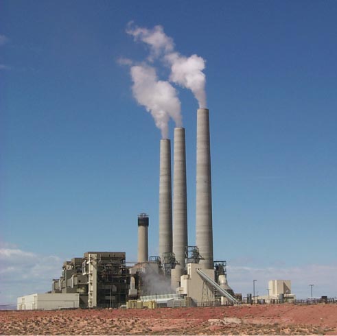
Let’s play a game! Try to locate power plants around the world!
My professor, Dr. Kevin Robert Gurney, from Arizona State University is launching a "crowd-sourcing" website, called Ventus (latin word for wind). He is collecting the information on all the world's power plants (location, emission, generation, fuel, etc). His research focus is CO2 emissions and geolocation. It is structured as a game and a winner will be deemed who provides the most useable information after the first year. This information will be used in his global fossil fuel emissions work, a piece of carbon cycle and climate science research.
You can be the winner! Please check out these websites:
- Website: http://ventus.project.asu.edu/
- Facebook: https://www.facebook.com/VentusProject?fref=ts
- Twitter: @carbonczar
P.S. Not sure what Dr. Gurney has decided for the prize. But I am sure it will be something good.
********************************************
Risa Patarasuk
Postdoc Research Associate
School of Life Sciences
Arizona State University
Banff Multi-Temp 2013

Multi-Temp 2013: The 7th International Workshop on the Analysis of Multi-Temporal Remote Sensing Images
Join us at MultiTemp 2013 for outstanding world‐class science, set in spectacular Banff National Park in the Canadian Rocky Mountains – a UNESCO World Heritage Site.
25‐27 June 2013 Banff Alberta Canada http://geog.ucalgary.ca/multitemp2013
REGISTRATION: Early-bird rates are available through 31 May 2013 at: http://geog.ucalgary.ca/multitemp2013/content/registration
For more information visit: http://www.asprs.org/a/society/divisions/rsad/International_MultiTemp_Remote_Sensing_Conference-SUMMARY_8_May_2013.pdf
Further information is also on the conference website, above.
Like us on Facebook (www.facebook.com/Multitemp2013)
Follow us on Twitter (@Multitemp 2013)
Questions, Contact: Ross Lunetta at: Lunetta (dot) Ross (at) epa (dot) gov


